Esri Shape
Menu: Insert > Map Import >
Import ESRI shape (![]() )
)
Ribbon: Insert > Map Import (![]() )
)
Command: ESRISHAPE
MAPIMPORT
> SHP
Allows to access to existing spatial and attribute data in ESRI shape files (.shp), where are stored attributes (data) and geometry.

How to bring a SHP format file in a dwg:
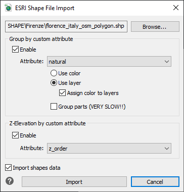
- Run the Esri Shape insert command (ESRISHAPE).
- Select the Shape (.shp file) by the BROWSE... button.
- Activate the Enable option to create groups from the shape data, if you want to divide the imported entities.
- Choose the attribute (from the shape data) to generate the groups.
- You can decide if you want to divide the imported entities by Layer or by Color.
- It's possible to create CAD entity Group of the imported objects (please note that this function is very slow).
- You can decide to import also the Shape data.
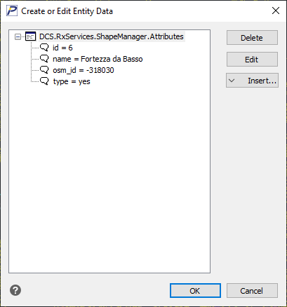
After this procedure, if you imported the Shape data, you can use the
Show Esri shape data ( ) command to show the
data related one selected entity.

OPTIONS:
Z-Elevation by custom attribute: Allows to use the attribute that
indicates the Elevation to compose the graphic elements.
Import shapes data: Allows to decide if the Shape data are imported.
If this flag is turned off, only the vectorial graphic informations are
imported.

 en
en italiano
 čeština
 Deutsch
 français
 hrvatski
 magyar
 polski
 српски
 русский
 中文
中文 中文
中文 한국어
한국어 español